|
|
|
|
The definition of a protected area adopted by
IUCN is:
An area of land and/or sea especially dedicated
to the protection and maintenance of biological diversity, and of
natural and associated cultural resources, and managed through
legal or other effective means
Although all protected areas meet the general
purposes contained in this definition, in practice the precise
purposes for which protected areas are managed differ
greatly.
Protected Area Management Categories
IUCN has defined a series of six protected area
management categories, based on primary management objective. In
summary, these are:
CATEGORY Ia: Strict Nature Reserve:
protected area managed mainly for science
Definition Area of land and/or sea
possessing some outstanding or representative ecosystems,
geological or physiological features and/or species, available
primarily for scientific research and/or environmental
monitoring.
CATEGORY Ib Wilderness Area:
protected area managed mainly for wilderness protection
Definition: Large area of unmodified or
slightly modified land, and/or sea, retaining its natural character
and influence, without permanent or significant habitation, which
is protected and managed so as to preserve its natural
condition.
CATEGORY II National
Park: protected area managed mainly for ecosystem protection and
recreation
Definition: Natural area of land and/or sea,
designated to (a) protect the ecological integrity of one or more
ecosystems for present and future generations, (b) exclude
exploitation or occupation inimical to the purposes of designation
of the area and (c) provide a foundation for spiritual, scientific,
educational, recreational and visitor opportunities, all of which
must be environmentally and culturally compatible.
CATEGORY III Natural
Monument: protected area managed mainly for conservation of
specific natural features
Definition: Area containing one, or more,
specific natural or natural/cultural feature which is of
outstanding or unique value because of its inherent rarity,
representative or aesthetic qualities or cultural
significance.
CATEGORY IV Habitat/Species
Management Area: protected area managed mainly for conservation
through management intervention
Definition: Area of land and/or sea subject
to active intervention for management purposes so as to ensure the
maintenance of habitats and/or to meet the requirements of specific
species.
CATEGORY V Protected
Landscape/Seascape: protected area managed mainly for
landscape/seascape conservation and recreation
Definition: Area of land, with coast and sea
as appropriate, where the interaction of people and nature over
time has produced an area of distinct character with significant
aesthetic, ecological and/or cultural value, and often with high
biological diversity. Safeguarding the integrity of this
traditional interaction is vital to the protection, maintenance and
evolution of such an area.
CATEGORY VI Managed Resource
Protected Area: protected area managed mainly for the sustainable
use of natural ecosystems
Definition: Area containing predominantly
unmodified natural systems, managed to ensure long term protection
and maintenance of biological diversity, while providing at the
same time a sustainable flow of natural products and services to
meet community needs.
|
|
|
|
|
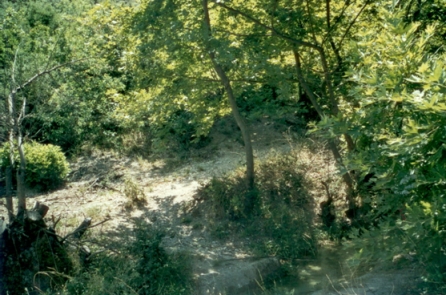
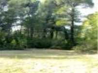
Is situated 10 km far from the city of Korca on
the back of the mountain of Morava. Its total area is about 1.380
hectares. The entire park area is rich in water springs which
appeal mostly to the visitors.
The flora and fauna of this park is rich and
various. The most dominant plants are the ash wood, which gives to
this park tourists and environmental values. Here, also there is
black pine, maple of mountain and the extremely rare taxus baccata.
The Park is mostly inhabited by big mammals.
This park has incomparable values for developing
the eco-tourism, winter sports, mountain climbing, excursions
etc.
|
|
National Parks of "Bredhi Hotoves" (The fir of
Hotova)
With a surface of about 1.200 hectares, is
situated in the region of Frasheri, about 35 km in northeast of the
town of Permeti. This park forms a giant green crown with apparent
contrasts that cause to be very attractive for the visitors.
The animal world is very attractive for its
variety of species ranging from the brown bear, wolf, fox, marten,
hind and wild pig etc.
Due to beautiful and picturesque nature, healthy
climate, pure air and nearness to the urban areas, this Park gains
tourists, recuperative and sportive values at every season of the
year. The sorts of tourism to carry out are echo-tourism, champing,
excursions etc.
|
|
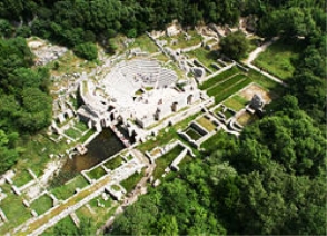
National Parks of "Butrint" (The pass of
Shtama)
Is situated nearly 25 km in south of the city of
Saranda. Its scientific, tourists and health recovering values
combine with a bio-diversity of national and international
importance. Its surface is about 2.500 hectares.
The area “ Channel of Cuka-Gulf and Island
of Ksamil” offer relax and recreation. Its islands form a
real oasis for the wonderful coastal and terrestrial landscape.
They are covered with typical Mediterranean vegetation. Suchlike is
the wood near the ancient city of Butrint, which consists of a real
subtropical jungle, where high trees and laurels are dominant.
It’s an area of significant importance for the tourism in the
country. First for the cultural tourism with the ancient city of
Butrint that is under the protection of UNESCO, blue tourism in
Ksamil, echo-tourism in Lake of Butrint, aquatic sports also in
Lake of Butrint , fishing, etc.
|
|
Mount Dajti National Parks
Situated at the eastern part of the capital it
covers an area of about 3.300 hectares.
The fauna here is abundant in varieties and
impressive features. The park is the most important zone for such
big mammals as wild pig, wolf, fox, rabbit, brown bear, wild cat
etc.
One-day visitors in particular frequent the Park.
However, it offers a number of possible accommodation for the
visitors. The types of activities to experience here are
excursions, skiing, air sports, mountain climbing etc.
|
|
National Parks of "Pisha e Divjakes" (The pine of
Divjaka)
With a surface of about 1.250 hectares is
situated 5 km far from Divjaka and about 40 km from the center of
the city of Lushnja. At the same time this park is a part of the
complex called Lagoon of Karavastaja, an area since 1994 under the
protection of the International Convention of Ramsar. The park is
one of the most important ecosystems of the entire Albania.
A typical representative of the ecosystem is the
curl pelican (pelicanus crispus), and about 6,4% of its entire
population nests in the Lagoon. Karavastaja is the furthest western
point of nesting of this sort of bird in Europe.
In this Park there are a lot of possibilities for
developing eco- tourism, blue- tourism, sportive hunting, bird
watching, fishing etc
|
|
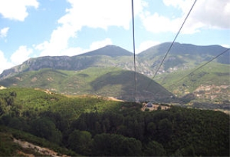
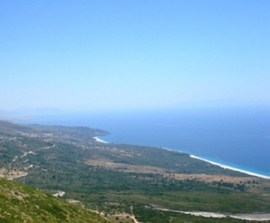
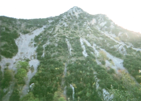
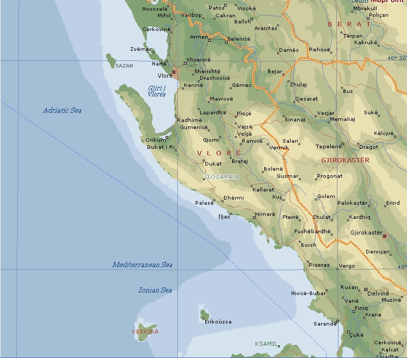
National Parks of "Llogara"
Is situated about 40 km in south- east of Vlora
on the border between Adriatic and Jon seas. It’s altitude
ranges from 470 to 2018m. Near the Pass of Llogara are met trees
and interesting crown shapes, resulting from the tides of wind. An
astonishing example of it is “ Pisha Flamur” (Flag
Pine), a rare monument of nature with scientific and tourist
values.
This park offers a fine and attractive landscape
and characteristic areas with dominant points. Its vegetation
consists mainly of such conifers as the black pine and ash-tree.
The park of Llogara has a significant importance both as a tourist
destination and as a transit bridge to the Ionian coast. It has
great potential for the development of eco-tourism, air sports,
excursions and trekking. It is a climatic place because here are
lively mixed both mountain and marine fresh air. For the air sports
fans this park offers accommodation possibilities.
|
|
|
|
|
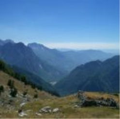
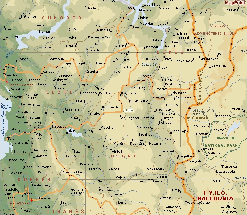
National Parks of "Lura"
With a surface of 1.280 hectares it is situated
in the eastern side of the mountain massive of “ Kunora e
Lures”. Its 14 icy lakes offer picturesque and attractive
environments at an altitude of 1.350-1.720 m. Among the many lakes
the one that stand out are the Big Lake 32 hectares, Lake of Pines
13 hectares, Black Lake 8 hectares and Lake of Flowers 4 hectares.
In winter these lakes freeze. In the southern part of the park
there is a meadow called “Field of Mares” which offers
a relaxing view, since its vegetation is miscellaneous with
multi-color flowers and full of coniferous trees. This park offers
various possibilities for developing eco-tourism, winter sports,
equitation, horse riding etc.
|
|
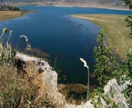
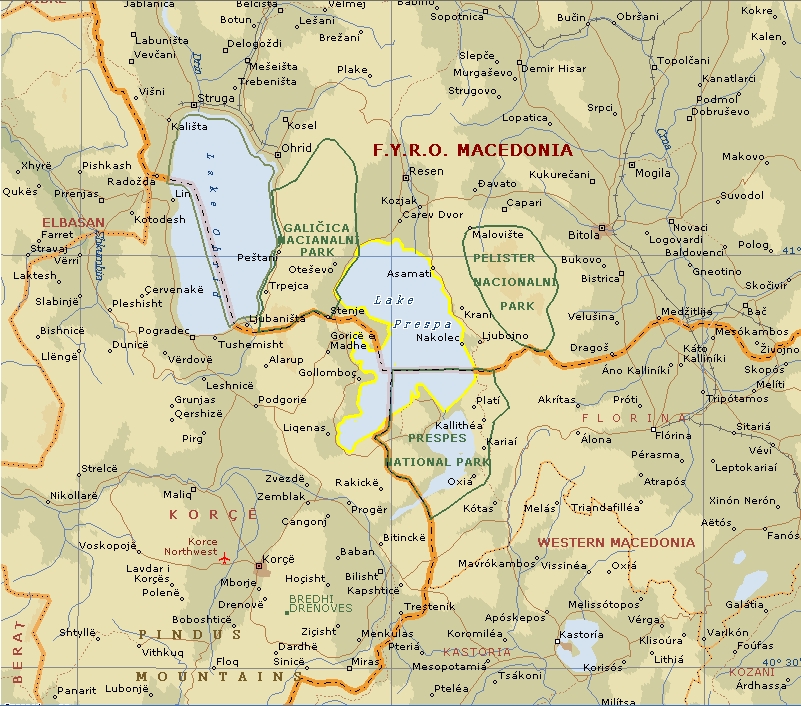
National Parks of "Prespa" (The pass of
Shtama)
It has a surface of about 27.750 hectares and is
situated at the cross border of Albania, Greece and Macedonia. It
consists of both lakes Big Prespa and Small Prespa as well their
reservoirs of water.
This area is very rich in cultural values. Worth
mentioning is the eremitic churches of Byzantine Age and the cave
of Treni, located in the lake of Small Prespa. Here are discovered
settlements of the early age of bronze, where the castle of Trajan
is among the largest prehistoric place of this district, build up
in the 8th century BC and the church of Saint Mary built up in the
island of Maligrad in 14th century. This region is considered of
significant echo-tourism potential.
The Lake of Big Prespa and the Lake of Small
Prespa are part of the Balkan Park of Prespa, by an agreement
signed by the respective Prime Ministers. There is potential for
development of echo- tourism, recreation, sportive fishing,
gathering and trading of medicinal plants, familiar tourism, bird
watching, blue tourism, aquatic sports etc.
|
|
|
|
|
National Parks of "Qafe Shtama" (The pass of
Shtama)
Has a surface of about 2.000 hectares and is
situated at about 2 km in northeast of the town of Kruja. In
general the view of this Park is 360 degree and picturesque. Here
we can mention the fountain of “Mother Queen” with
pure, cold and curative water. Many people frequent this area for
its high curative values as well as the landscape it offers. On the
north border there is a recreation center. Attention is paid to the
development of tourism where attractive are the lakes situated near
the Park, at its northern part.
There are possibilities here for developing the
echo-tourism, curative tourism (for diseases of respiratory ways),
climbing etc.
|
|
National Parks of "Thethi"
Situated in the Albanian Alps, near Bjeshket e
Namuna, 70 km far from Shkodra it has an area of about 2.630
hectares. Through this park flows the River of Thethi, which has an
outpouring of about 1000- 1300 l/sec. A very interesting natural
monument is the waterfall of Grunasi, very charming and picturesque
with its water falling from an altitude higher than 30 m. The park
is known for its variety of habitats and vegetation.
It is important because it represents the most
populated area of lynx- lynx with about 50 principals specie this
liable.
There is a tendency of its inhabitants to move
towards urbane areas, but during the summer season they return for
their holidays, highlighting in this way their efforts for
developing the familiar tourism.
|
|
National Parks of "Mali Tomorit" (Mount
Tomorri)
With a surface of 4.000 hectares is situated in
the east of the city- museum of Berati. With its peak of 2415,7m
above the sea level, the Mountain of Tomori gives the impression of
a giant natural castle. The natural beauties of the park are
evident in every season of the year.
The kind of activities to carry out here is
winter sports, climbing, trekking and pilgrimage. Every year at the
end of August, thousands of ‘pilgrims’ climb at the
Masjid of Kulmak, housing the grave of the religious leader Abaz
Aliu, to carry out the religious rites of Bektashian Sect.
|
|
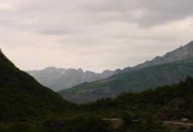
National Parks of "Lugina e Valbones" (The valley
of Valbona)
It has a surface of about 8.000 hectares and is
situated 25-30 km in northwest of the city of Bajram Curri. It
expands among high mountains and shows off a fantastic complexion
of colors in every season, thus giving the image of a valley full
of labyrinths and surprises. Its scientific, tourist and health
recovering values are combined with a bio-diversity of national and
international importance. Its rocky and attractive peaks, the sides
covered with wood, the flow of brooks and river Valbona, viewed
from above, create the image of a giant and marvelous crater as a
small panorama of natural beauty.
The nature of this park is full of varieties
suitable for tourism, fishing, relaxation, amusing and mountain
climbing as well as winter sports. In the inner part of the Park
there are a lot of grottos and caves. The most eminent is the Cave
of Dragobia, where lay the remains of Bajram Curri, a national
hero.
|
|
National Parks of "Zall Gjocaj" (The pass of
Shtama)
It has a surface of about 140 hectares and is
situated approximately 40 km in northeast of the city of Burrel. It
offers a very picturesque view and good possibilities for
developing the echo-tourism. The presence of numerous sources and
system of ravines make it more beautiful.
Therefore there is a typical plant kingdom of
mountain areas: lack pine and beech. Very attractive are the old
woods of 150-200 years old with giant shape and view dressed with
ivy plants, moss and mushrooms. Among the animals here, we can
mention the brown bear, wolf, fox, wild pig etc.
|
|
|
|
|
|
|
|
|
|
|
|
|
|
|
|
|
|
|
|
|
|
|
|
|
|
|
|
|
|
|
|
|
|
|
|
|
|
|
|
|
|
|
|
|
|
|
|
|
|
|
|
|
|
|
|
|
|
|
|
|
|
|
|
|
|
|
|
|
|
|
|
|
|
|
|
|
|
|
|
|
|
|
|
|
|
|
|
|
|
|
|
|
|
|
|
|
|
|
|
|
|
|
|
|
|
|
|
|
|
|
|
|
|
|
|
|
|
|
|
|
|
|
|
|
|
|
|
|
|
|
|
|
|
|
|
|
|
|
|
|
|
|
|
|
|
Indice
|
|
|
territorio
|
|
|
|
|
territorio
|
|
|
|
|
territorio
|
|
|
|
|
territorio
|
|
|
|
|
territorio
|
|
|
|
|
territorio
|
|
|
|
|
territorio
|
|
|
|
|
territorio
|
|
|
|
|
territorio
|
|
|
|
|
territorio
|
|
|
|
|
territorio
|
|
|
|
|
territorio
|
|
|
|
|
territorio
|
|
|
|
|
territorio
|
|
|
|
|
territorio
|
|
|
|
|
territorio
|
|
|
|
|
territorio
|
|
|
|
|
città
|
|
|
|
|
città
|
|
|
|
|
città
|
|
|
|
|
monumento
|
|
|
|
|
monumento
|
|
|
4.01
|
|
commerciale
|
|
|
4.02
|
|
commerciale
|
|
|
4.03
|
|
commerciale
|
|
|
4.04
|
|
commerciale
|
|
|
4.05
|
|
commerciale
|
|
|
|
|
1.01
“Virtual Albania
online” The Virtual Albania Online Company (lingua
inglese)
Descrizione:
La pagina, ottimizzata per una risoluzione
800x600, si articola in due bande:
Banda sx: elenco
delle municipalità (Berat, Diber, Durres, Elbasan, Fier,
Gjirokaster Gramsh, Kolonje, Korce, Kruje, Kukes, Librazhd,
Lushnje, Mat, Mirdite, Permet, Pogradec, Puke, Sarande, Shkoder,
Skrapar, Tepelene, Tirana, Tropoje, Vlore)
Banda dx: cartografia con collegamenti a schede di
approfondimento per ciascuna municipalità
Punti di forza:
-
utilizzazione di una mappa
Note:
Il sito appare in
costruzione in quanto non tutte le municipalità hanno una
scheda di approfondimento (es.: Puka); non tutte le schede hanno
attivi i collegamenti ad ulteriori approfondimenti (es.: Elbasan ha
2 collegamenti attivi e 2 disattivi); non funziona la navigazione
attraverso le schede di approfondimento.L’esclusivo
collegamento alle sole municipalità è riduttivo; andrebbe
potenziato mediante ulteriori sezioni, elenchi e/o funzioni di
ricerca.
|
|
|
|
1.02
“Home of Albanians online”
Albanian.com (lingua inglese)
Descrizione:
Il sito riporta alcune sezioni, articolate in
elenchi, tra cui:
-
Località (Tirana, Durrës, Shkodra,
Kruja, Vlora, Gjirokastra, Korça, Saranda,
Berat)
-
Alberghi
(elenco suddiviso per località: Tirana, Berat, Durrès,
Elbasan, Gjirokastra, Korca, Kruja, Kukès, Lezha, Lushnja,
Pogradec, Saranda, Shkodra, Vlora; riporta indirizzo - solo per
Tirana-, numero delle stanze e numeri
telefonici)
-
Risorse
(Butrinti, Apollonia, Ponte di Mesi (Mat), Strada tipica nel
villaggio di Vuno, fortezza medievale nelle alpi albanesi) con
collegamento a schede di approfondimento
Punti di forza:
-
immagini; informazioni nella sezione
“Government”
Note: e schede di approfondimento hanno un
livello di dettaglio molto differenziato e in alcuni casi scadente
(p. es.: il collegamento per Vuno è solo
un’immagine)
|
|
|
|
1.03 "Albanian Tourism” Ministry of Territorial
Planning and Tourism (albanese e inglese)
Descrizione:
La pagina, ottimizzata per una risoluzione
800x600, si articola in tre bande:
-
Banda sx:
elenco voci (benvenuto, informazioni generali, come arrivare in
Albania, notizie storiche, cultura, siti interessanti, servizi
turistici, attrazioni turistiche, attrazioni naturali e galleria di
immagini), la cui selezione comporta usualmente la visualizzazione
di un secondo elenco (esterno al frame)
-
Banda
centrale fissa con informazioni di carattere
generale
-
Banda dx:
finestra (con testo a scorrimento ove necessario) per visualizzare
la descrizione associata alla voce selezionata fuori frame (cfr.
banda sx).
Esempi di elenchi di secondo
livello:
-
Siti
interessanti: Korça, Pogradeci, Berat, Durres, Kruja,
Gjirokastra, Saranda, Shkodra, Tirana, Vlora
-
Hotel:
Tirana, Durres, Vlore, Sarande, Korce, Lezhe, Shkoder (in questo
ordine e con queste voci differenti dalle
precedenti)
Punti di forza:
-
grafica
curata; ricchezza di immagini e contenuti:
-
brochure
pdf su alberghi per le città più importanti, comprensivo
di caratteristiche dei servizi offerti in forma di icona, con
stralcio planimetrico;
-
elenco
località sciistiche: area di Korca, Shishtaveci (Kukes), Dajti
(Tirana), Gjinari (Elbasan), Tomori (Berat), Alpi albanesi: Razma,
Boga,Thethi;
-
elenco
località indicate per climbing e trekking: Korabi e Lura
(Dibra), Maja e Hekurave e Kollata (Tropoja), Vermoshi, Boga,
Thethi and Razma (Shkodra), Malesia e Madhe, Alps of Terbuni
(Puka), passo di Llogaraja (Vlora).
Punti di debolezza:
-
elenco di
secondo livello visualizzato fuori frame; assenza di un elenco di
terzo livello (fatta eccezione per gli alberghi), con la
conseguente visualizzazione di informazioni non mirate (es.: alla
voce Ristoranti è associata una lunga descrizione di esercizi
per alla voce “Laghi” è associata la descrizione
di diverse località: Ohrid, Shkodra,
Prespa).
-
La
sezione immagini non ha didascalie o riferimenti. Sono assenti
informazioni che consentano la localizzazione di molte mete; non
esiste cartografia.
Note:
Il sito appare in
costruzione, in quanto alcune voci di secondo livello non producono
risultati (es.: gastronomia)
|
|
|
|
1.04 "AlbtourGuide” (lingua albanese, italiana e
inglese)
La pagina, ottimizzata per una risoluzione
800x600, si articola in due bande:
Banda sx: elenco
voci raggruppate in 6 sezioni
Banda dx: finestra
(con testo a scorrimento ove necessario) per visualizzare un elenco
di risorse associato alla voce selezionata (cfr. banda sx); la
selezione dell’immagine o della denominazione comporta la
visualizzazione di una scheda di
approfondimento.
Punti di forza:
-
presentazione sintetica esaustiva associata a
miniatura fotografica della risorsa;
-
ricchezza di informazioni per alcune sezioni
– per es. musei: Museo Storico Nazionale (Tirana), Museo
Archeologico (Durazzo), Museo Gjergj Kastrioti Scanderbeg (Kruja),
Museo Nazionale Etnografico (Kruja), Museo Nazionale Onofri
(Berat), Museo Nazionale Etnografico (Berat), Museo Nazionale del
Sepolcro di Scanderbeg (Lezha), Museo dell'Arte Medioevale (Korca),
Museo Nazionale dell'Educazione (Korca), Museo Nazionale
dell'Indipendenza (Valona).
Punti di debolezza:
-
assenza di un elenco di terzo livello nella banda
sx (l’impostazione si presta comunque
all’organizzazione ad albero tipica della funzione esplora
risorse di windows);
-
assenza di informazioni che consentano la
localizzazione delle risorse;
-
assenza di mappe
Note:
Il sito appare in
costruzione: la funzione ricerca nella scheda di approfondimento
della risorsa non produce risultati corretti; la ricerca di
alberghi, motel e ristoranti non produce
risultati
|
|
|
|
1.05 “Albania
Tour” (italiano)
Informazioni non strutturate (notizie ed elenco
alberghi)
Punti di forza:
Punti di debolezza:
Note:
|
|
|
|
1.06 “Albanian Travel
and Hospitality Service” (albanese e
inglese)
Punti di forza:
-
presentazione sintetica esaustiva associata a
miniatura fotografica del servizio
-
presenza di tour; ad ogni tappa è presente un
link ad una pagina di approfondimento della
località
Punti di debolezza:
-
Assenza di informazioni su località e
risorse
-
Alle località selezionabili non sempre fa
riscontro un’informazione associata (es.: alberghi di
Shkodra)
-
Assenza di collegamenti diretti alle pagine di
approfondimento delle località
Note:
Galleria di immagini strutturata (file,
description, credits, title, copyright) ma priva di
informazioni
|
|
|
|
1.06 “Albanian Youth
Hostels Association” (albanese, inglese e
tedesco)
La pagina, ottimizzata per
una risoluzione 800x600, si articola in tre
bande:
Banda sx: elenco delle sezioni
Banda centrale: informazioni associate alla
sezione prescelta
Banda dx: informazioni accessorie, collegamenti e
pubblicità
Dalla pagina relativa alla
sezione Albania è possibile accedere a pagine di
approfondimento su alcune città (Berat, Tirana, Vlora,
Durrës, Gjirokastra, Korça, Kruja, Pogradec,
Saranda, Shkodra)
Punti di forza:
la Sezione “Picture
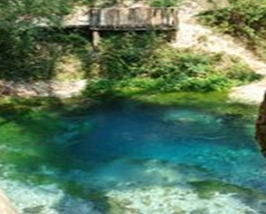
from” contiene ottime fotografie (Ardenica, Berat, Butrint,
Brarë/Tirana, Këlcyra, Ksamil, Llogara, Lake Ohrid,
Orikum, Lake Prespa, Saranda, Blue Eye, Tepelena, Tirana, Tomorri
National Park, Vlora, Voskopoja); la sezione eventi è di
immediata leggibilità (presenta un elenco strutturato con
icona, periodo e descrizione sintetica, associato a pagina di
approfondimento) e gestione (tramite calendario); è presente
l’orario ferroviario.
Punti di debolezza:
l’accesso alla sezione
“Cities” non è intuitivo; la sezione
“Picture from” è priva di riferimenti/commenti; la
sezione eventi consente la ricerca esclusivamente per data (non
è prevista la possibilità di selezionare una tipologia di
evento); le informazioni sulle città sono
ridotte.
Note:
Per
la municipalità di Berat è disponibile una mappa
turistica.
|
|
|
|
1.08 “Welcome to
Albania” (albanese, inglese)
Collezione di pagine con immagini e descrizioni di
località e monumenti.
Punti di forza:
-
ricchezza di contenuti e
immagini
Punti di debolezza:
-
home page dispersiva; sito non strutturato; menu
in inglese e documentazione in entrambe le
lingue
-
pagine non disponibili (es.:
http://www.geocities.com/albaland/archaeology)
Note:
ultimo aggiornamento: 2001
|
|
|
|
1.09 “Inyourpocket
– essential city guide” (inglese)
Il sito è una guida ai paesi dell’est e
alle relative capitali. La pagina relativa alla nazione presenta
sulla destra due funzioni (Hot links, Goodies) dotate di
sottolivello e una descrizione sintetica in cui si ritrovano
collegamenti ad altre pagine (tra cui Tirana, Southern Albania e
Sightseeing - Excursions).
La pagina relativa alla capitale prevede una lista
di funzioni standard nella parte superiore; sulla destra, alle
predette funzioni (Hot links, Goodies) si aggiunge
“Features” che, per Tirana, è dotata di un solo
sottolivello “Southern Albania”, che rimanda ad una
pagina di presentazione dettagliata degli aspetti turistici di
quella zona.
La selezione di una funzione standard comporta la
sostituzione della funzione “Features” con quella
scelta di volta in volta e con il relativo sottolivello, associato
ad un cambiamento del colore di fondo:
-
Arrival & Transport: Arriving by boat,
Arriving by bus, Arriving by car, Arriving by plane, Arriving by
train, Public transport, Street smarts, Taxis, The Kosovo border,
Tourist information, Airlines, Car rental, Trains, Travel
Agents
-
Where to Stay: private rooms, budget, cream
of the crops
-
Where to Eat: cafè, pizza,
upmarket
-
Nightlife: Bar e Club
-
Sightseeing: Excursion, Museum,
Sight
-
Culture: rimando a documentazione cartacea (cfr.
Nota)
-
Shopping: Books, Fashion, Flowers, Souvenirs,
Supermarkets, Shopping Centres
-
Directory: Business, Officials, Sports, Useful
Addresses (è previsto un elenco di terzo
livello)
-
Mail & Phones: Express mail, Internet
cafés, Internet providers, Mobile phones, Post offices, Postal
rates, Public telephones, Telephone calls
Punti di forza:
-
Struttura fino a tre livelli di agevole
consultazione; sezione trasporti con orari; uso di legenda
unificata per le descrizioni dei servizi offerti
Punti di debolezza:
-
assenza di immagini e cartografia; uso di termini
in gergo per le classificazioni
-
assenza di una funzione che consenta il rimando
alle città nella pagina relativa alla
nazione
Note:
Vengono segnalati due
mensili di informazione sugli eventi culturali in
Tirana:
-
“Buletini Informativ Kulturor i Tiranes”
(lingua francese, inglese ed italiana), disponibile presso Tirana
International Hotel e Hotel Rogner Europapark
-
“ARTirana”, supplemento gratuito della Gazeta
Shqiptare (lingua inglese ed italiana).
|
|
|
|
1.10 "Lonely Planet”
(inglese)
La pagina presenta le seguenti funzioni:
WORLDGUIDE, Introduction, See, Image Gallery, Transport, Money,
Essential Info
“See” fa riferimento alle
località da visitare, per le quali è prevista una pagina
di approfondimento: Shkodra, Tirana, Butrint (archeological site),
Gjirokastra Castle (castle; museum), Tirana clock tower (views;
tower)
Punti di forza:
-
grafica elegante e lineare
Punti di debolezza:
-
informazioni sulle località
sintetiche;
-
ridotto numero di località in
elenco;
-
assenza di testi in lingua
albanese.
Note:
Sito
essenzialmente preposto alla vendita delle guide
turistiche
|
|
|
|
1.11 "Outdoor Albania”
Sito orientato alla gestione dei servizi
turistici; prevede numerose e articolate attività
all’aria aperta (Trekking, Sci, Snow shoeing, Climbing, Sea
Kayaking, White Water Kayaking, Rafting, Mountain Biking, 4W
driving); per ogni attività è prevista una breve nota
descrittiva generica. Un elenco di località viene riportato
esclusivamente per il kajak: ”Valbona, Kir, Fani i
Vogël, etc (WW class. III-IV-V-VI) and the southern bigger
volume ones: Devoll, Osum, Vjosa, etc. (WW class.
II-III-IV-V)”.
Generiche anche le
informazioni relative alla sistemazione alberghiera:
“camping, private house hosting (especially in the villages),
bed and breakfasts and hotels”.
Punti di forza:
-
Presenza di molteplici attività correlate
alla fruizione di aree naturali
Punti di debolezza:
-
Assenza di informazioni su località, risorse
e servizi
Note:
|
|
|
|
1.12 “Albania –
place of interest interactive map“
(inglese)
La pagina, ottimizzata per
una risoluzione 800x600, si articola in due
bande:
banda sx: collegamenti a tre tipologie di mappe
interattive (carta politica, fisica e luoghi di interesse); le
icone sono collegate a pagine di approfondimento
sintetiche;
banda dx: lista completa dei siti (Apollonia,
Berat, Butrint, Durrës, Elbasan, Gjirokastër,
Korçë, Krujë, Lake Ohrid, Mes, North Albanian Alps,
Pogradec, Sarandë, Shkodër, TIRANË, Vlorë,
Voskopojë) con collegamento a pagine di approfondimento
sintetiche.
Le pagine di approfondimento
contengono collegamenti sia alle pagine relative ad altri siti
fisicamente circostanti, sia ad altri siti web inerenti la risorsa
selezionata.
Punti di forza:
-
compresenza di una sezione mappe (con icone di
immediata comprensione) e liste (ad un solo
livello)
Punti di debolezza:
-
povertà di contenuti; assenza di informazioni
turistiche
Note:
|
|
|
|
1.13 “Albanian
Institute of Tourism and Environmental Developments”
(albanese e inglese)
Il sito offre schede descrittive di località
turistiche suddivise nelle seguenti categorie:
-
Coastal (Durresi, Saranda, Vlora,
Pogradeci)
-
Mountainous (Tirana, Korca)
-
Special Interests (Berati, Gjirokastra, Kruja,
Shkodra)
Punti di forza:
Punti di debolezza:
-
assenza di informazioni sui servizi
turistici
-
pagine con brani in albanese e menu in inglese
(home page, about us,…)
-
collegamenti vuoti (per es.:
education)
Note:
I visitatori del sito
possono partecipare ad una indagine avente come obiettivo il
miglioramento del servizio. Allo stato attuale la richiesta è
la seguente:
35.1% Tourist
Information
21.6%
Chat
16.2%
Apartments
13.5% City
Guides
13.5%
Forum
|
|
|
|
1.14
“Tripadvisor” (inglese)
Il sito presenta
informazioni essenzialmente su Tirana; si tratta tuttavia di
informazioni generiche o semplici elenchi. Ad esempio, per Tirana
sono previsti 24 attrazioni con relativo collegamento alla pagina
di approfondimento, priva, tuttavia, di informazioni, fatta
eccezione per l’indirizzo e l’eventuale presenza di
report inseriti dagli utenti, peraltro in altri database
(tripadvisor e inyourpocket)
Punti di forza:
Punti di debolezza:
Note:
Attrazioni in Tirana:
National History Museum, History museum; Et`hem Bey Mosque,
Religious site; Skanderbeg Square, Town
center/square/plaza; Grand Park (Parku i Madh), Park;
Museum of Natural Sciences, Natural history museum; Tanners'
Bridge, Bridge; Landmark/point of interest; Fan Noli statue,
Monument; Fortress of Justinian, Ancient ruins; Peace
Bell, Landmark/point of interest; Tomb of Kaplan Pasha,
Historic site; Unknown Partisan monument, Monument;
Archeological Museum, Natural history museum; Catholic Church
of St. Marie, Religious site; Orthodox Church of the Holy
Evangelist, Religious site; Clock Tower, Landmark/point of
interest; Skanderbeg Statue, Monument; Lord Bajron Piano Bar,
Bar/club; Murphy's Irish Pub, Bar/club; Manhattan Piano
Bar, Bar/club; Monaco, Dance club/disco; Boom Boom Room, Jazz
bar; Internet Cafe, Coffeehouse; Enver Hoxha Pyramid,
Architectural building; Skenderbeg Castle,
Castle
|
|
|
|
1.15 “Albanian Tourist
Guide”
Il sito presenta sulla destra una serie di sezioni
(menu principale, Albania in foto, Guida alle città,
Login)
Il menu principale prevede le seguenti voci: Home,
Review an Albanian Hotel, Albanian Embassies, Getting to Albania,
Tours to Albania, Albanian Recipes, Albania in Photos, Hotels in
Albania, Contact Us
Le guide attualmente presenti fanno riferimento
alle seguenti città: Berati, Durresi, Gjirokastra, Tirana,
Kruja,
Shkodra, Saranda, Pogradeci, Vlora, Korca,
Lezh
Ciascuna guida è una pagina con descrizioni
ed immagini.
Punti di forza:
-
elenco alberghi e immagini per
città
Punti di debolezza:
-
informazioni poco dettagliate sulle
località
Note:
|
|
|
|
1.16 “Virtual
Tourist”
Sito internazionale
essenzialmente basato sul contributo dei viaggiatori per gli
approfondimenti, organizzati in sezioni.
Non esiste un controllo sui contenuti, sia per
quanto concerne le fonti, sia per la visualizzazione dei dati.
Spesso i collegamenti predisposti non producono informazioni. Ad
esempio la selezione di Lekaj dall’elenco delle località
(Sarande, Tirana, Shkoder, Berat, Korce, Vlore, Vuno, Trash,
Butrint, Gjirokaster, Durres, Shengjin, Divjake, Elbasan, Permet,
Dhermi, Gojan i Eperm, Rreshen, Shtermen, Palermo, Kukes, Kucove,
Pogradec, Grece, Lekaj) produce una pagina di approfondimento che
riporta le categorie previste conl’indicazione dei contributi
e la possibilità di inserire un nuovo contributo: Hotels in
Lekaj (0 Reviews - 0 Photos); Write a new Hotels and Accommodations
Review; Things To Do in Lekaj (0 Reviews - 0 Photos); Write a new
Things To Do Review; Restaurants in Lekaj
Punti di forza:
-
archivi aperti al contributo
Punti di debolezza:
Note:
non è noto se e come
vengono controllati i contributi
|
|
|
|
1.17
TutorGig
Encyclopedia - Tourism in Albania
Punti di forza:
Punti di debolezza:
Note:
|
|
|
|
3.02 “Butrinto” (albanese, inglese,
italiano)
Il sito è una vera e propria guida ai tesori
del Parco con diversi itinerari archeologici o naturalistici che
possono essere percorsi grazie alle funzionali mappe interattive
che consentono di scoprire i tesori archeologici e naturalistici
custoditi e preservati negli anni dal Parco. Il tutto è
corredato da splendide foto in versione download e da preziose
notizie sulla storia e le attrattive del Parco, sulle bellezze
inedite della zona di Saranda e da curiosità sull'Albania in
generale. La comoda sezione "visiting Information" consente poi di
ottenere notizie utili su come raggiungere il Parco nel modo
più pratico e veloce.
Punti di forza:
-
grafica
accurata, contenuti esaustivi
Punti di debolezza:
-
sito
ottimizzato per una risoluzione 1024x768 (fuori standard per
l’Albania)
Note:
esistono margini di miglioramento, sia per quanto
concerne la navigazione nella planimetria, sia per
l’inserimento di viste panoramiche a
360°
|
|
|
|
3.01 “The Butrint Foundation”
(inglese)
Punti di forza:
-
grafica
chiara ed essenziale
-
sezione
“Travel Information” esaustiva ad eccezione delle
informazioni su pernottamento e ristorazione
Punti di debolezza:
-
assenza
di immagini sul sito
-
assenza
di testi in lingua albanese
Note:
|
|
|
|
2.03 “Tirana” (albanese e
inglese)
Punti di forza:
Punti di debolezza:
Note: La sezione “cultural
monuments” riporta in elenco solo 5 siti, cui sono associate
pagine di approfondimento esclusivamente storico-architettonico
(localizzazione territoriale assente); la sezione
“statistics” – “tourism” riporta 12
monumenti e siti da visitare
|
|
|
|
2.02 “Pogradec” (albanese,
inglese)
Sito del comune di Pogradec
Menu essenziale ma completo ed efficace (Culture
& Traditions; Archeology, Nature & History; Accommodations
& Restaurants; Excursion Suggestions; Maps)
Punti di forza:
-
contenuti
e immagini
-
sezione
“Accommodations & Restaurants” molto curata; file
pdf scaricabile
Punti di debolezza:
-
sezione
“maps” insufficiente (offre un ingrandimento della
mappa schematica visualizzata in apertura)
Note:
|
|
|
|
2.01 “Berat” (albanese,
inglese)
Sito del comune di Berat – raccolta di
immagini commentate, suddivise in categorie (archeologia,
architettura e varie)
Punti di forza:
Punti di debolezza:
assenza
di informazioni tutistiche
Note:
|
|
|
|
|
|
|
|
|
|
|
|
|
|
|
|
|
|
|
|
|
|
|
|
|